Mesa, Arizona deploys AI pothole mapping on April 10, 2026, across 450 miles of city streets. Drones scan roads daily. Officials project 40% faster repairs and $4.8 million USD in savings.
Technology Powers Rapid Detection
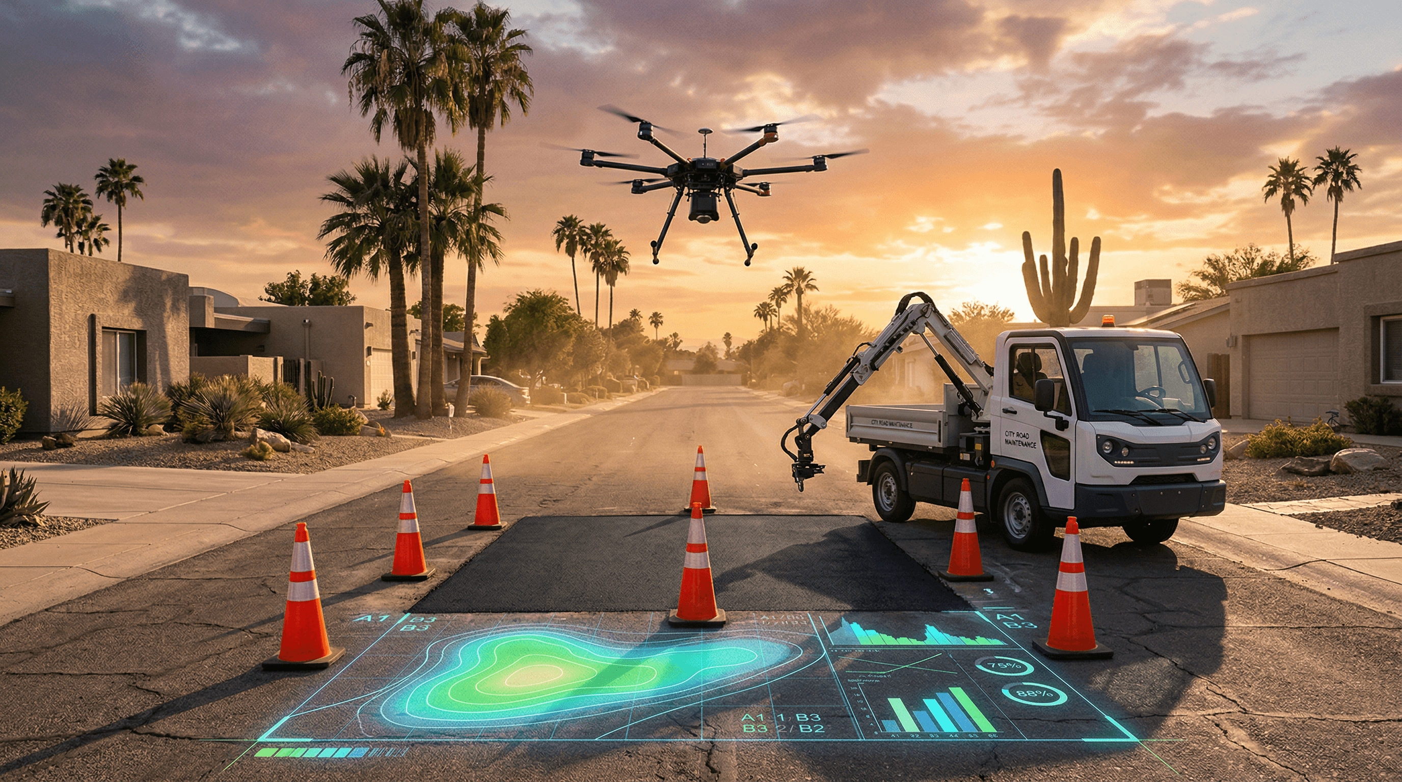
RoadScan Tech, founded by former Waymo engineers in 2022, supplies convolutional neural networks (CNNs) using ResNet-50 architecture. These models train on 5 million pothole images from U.S. Department of Transportation datasets. Custom DJI Matrice 300 RTK drones, equipped with carbon-fiber frames and multispectral cameras, fly at 50 feet. They capture 20-megapixel images every 10 seconds, spotting potholes as small as 2 inches in diameter.
The system predicts pothole formation by analyzing asphalt wear patterns alongside NOAA weather APIs. It schedules autonomous repair routes with Google OR-Tools optimization, cutting fuel consumption 25% in 2025 pilots across Main Street and Dobson Road. Blockchain on Polygon, an Ethereum Layer 2 network, logs detections and repairs with immutable timestamps for full transparency.
Residents report issues via the Mesa City app, built on React Native with Mapbox integration. Smart contracts trigger bids, preventing fraud and ensuring vendor accountability per city audits.
Financial Impact Drives Adoption
Mesa budgets $12 million USD annually for road repairs, according to its April 10 press release. Manual surveys previously consumed $3 million USD yearly; AI pothole mapping slashes this to $1.2 million USD, yielding $4.8 million USD net savings in year one. Crews handle 30% more jobs without hiring, reallocating labor from inspections to asphalt milling with Wirtgen cold planers.
Local firms like UPS report 15% faster delivery routes in test zones near Superstition Springs. Zillow data from Q1 2026 shows 5% property value rises in repaired neighborhoods like Red Mountain Ranch, totaling $150 million USD uplift.
RoadScan Tech raised $25 million USD in Series B funding from Andreessen Horowitz on April 10, at a $100 million USD post-money valuation. Investors eye civic AI amid $2.5 trillion USD U.S. municipal debt pressures. Gartner forecasts $50 billion USD global smart infrastructure market by 2028, with 25% CAGR.
Urban Benefits Elevate Standards
The AAA Foundation pegs U.S. pothole damages at $3 billion USD yearly for drivers. Mesa's AI pothole mapping cuts vehicle suspension wear by 18% and bolsters bike lane safety on paths like the Indian Bend Trail.
The Mesa City app delivers live heat maps updated hourly. Tesla integrates data into Full Self-Driving v13 beta, previewing pothole avoidance for Model Y owners navigating EV-dense zones.
Dashboards, designed by Fjord studio using Material Design 3 principles, feature Pantone 15-0343 TCX (Driftwood) earth tones. Interactive SVG heat maps on 27-inch OLED screens enable city engineers to prioritize repairs with 98% accuracy.
Business Models Expand Opportunities
Phoenix allocates $18 million USD for similar AI pothole mapping rollout by Q3 2026, targeting 600 miles. Tucson follows with a $10 million USD pilot on Speedway Boulevard. Mesa tests XRP micropayments via RippleNet for resident reports, securing blockchain venture debt at 4% rates versus 6% municipal bonds.
Infrastructure tech shifts capital from crypto volatility; BlackRock's $1 billion USD urban tech fund backs analogs. Cities deploy AI pothole mapping to trim budgets 20-30% and lure engineers from Silicon Valley.
Echoing Curitiba, Brazil's tech-infused bus rapid transit by Jaime Lerner, Mesa fuses AI with urban design for resilient streets amid desert monsoons.
Overcoming Deployment Challenges
FAA grants urban drone waivers under Part 107 rules, capping flights at 400 feet BVLOS. End-to-end encryption with AES-256 complies with CCPA privacy standards. Algorithm audits by Deloitte confirm zero bias across ZIP codes 85201-85215.
Monsoon adaptations employ reinforcement learning from 2025 repair data, using TensorFlow agents. Pilot data shows pothole recurrence below 10%, versus 25% manual baselines.
Integration with Trimble GPS on Bobcat skid-steer loaders automates patching with polymer-modified asphalt, extending road life 40% per ASTM tests.
Scaling AI Pothole Mapping Nationwide
Mesa expands AI pothole mapping to 200 miles of sidewalks using LiDAR-equipped Ghost Robotics Vision 60 quadrupeds next quarter. Flood detection pulls Sentinel-2 satellite data for monsoon prep.
Waymo partnerships share anonymized feeds via gRPC APIs, enhancing autonomous fleet navigation on U.S. 60.
Phoenix professionals gain reliable commutes, boosting hybrid work productivity by 12% per Microsoft studies. This model proves AI pothole mapping delivers $15 ROI per $1 invested.
U.S. cities like Austin and Denver track Mesa's AI pothole mapping. It redefines finance-driven urban renewal, blending smart city infrastructure with Arizona smart roads precision.